AutoMap
UNet CNN - AI Map Generation from Satellite images
Jun 2024
PythonPyTorchUNetAttention UNet
About
AutoMap is a utility tool designed to automate road infrastructure detection using satellite imagery. By leveraging deep learning models like UNet and Attention UNet, it processes satellite images providing accurate predictions for large-scale mapping.
This project was developed as a Research Project as a part of KAIST's (Korea Advanced Institute of Technology) summer research program.
Details / Technology
- Selected among 18 students worldwide for the prestigious summer research program at KAIST, focusing on deep learning research
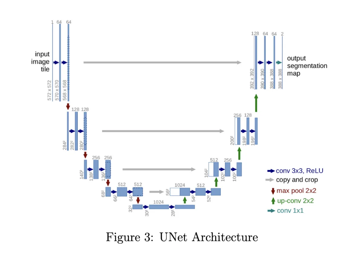
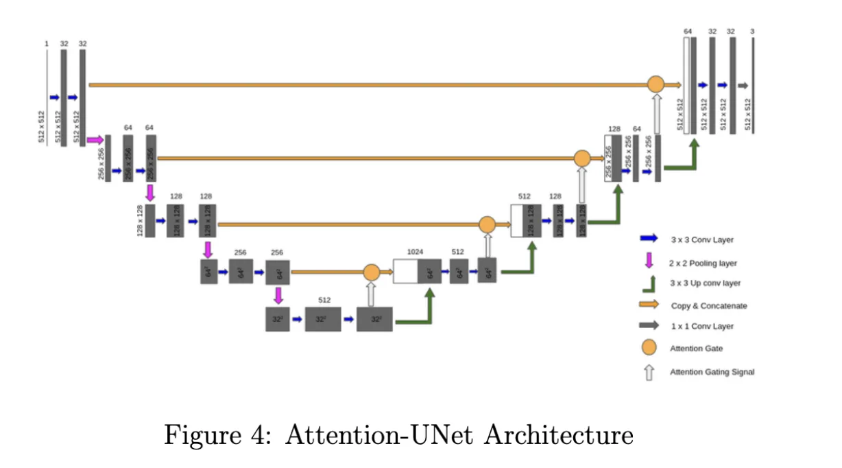
- Developed UNet and Attention UNet models to automate road infrastructure detection using satellite imagery, aimed at reducing manual labor in road mapping.
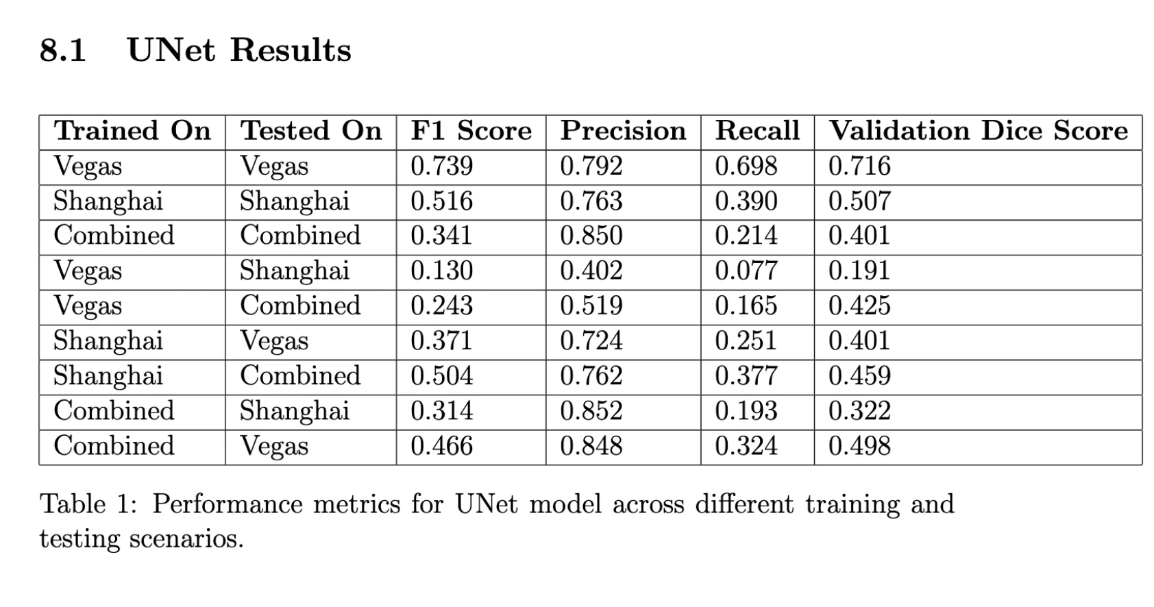
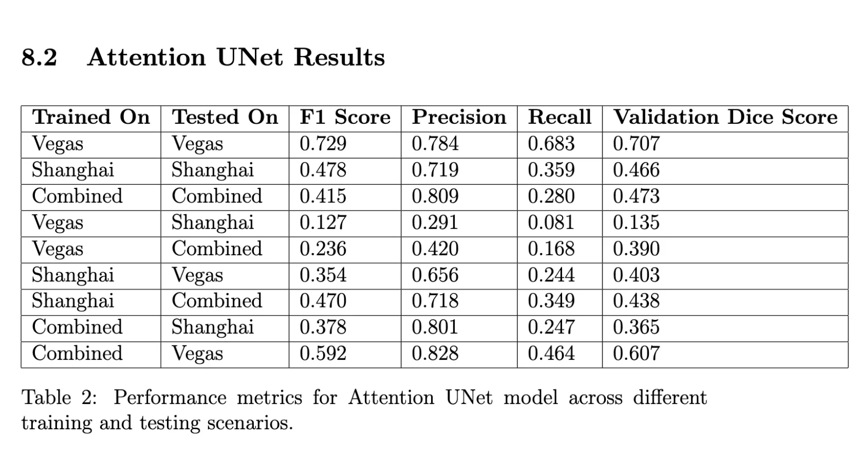
- Achieved a strong 0.73 F1 score on the final model.
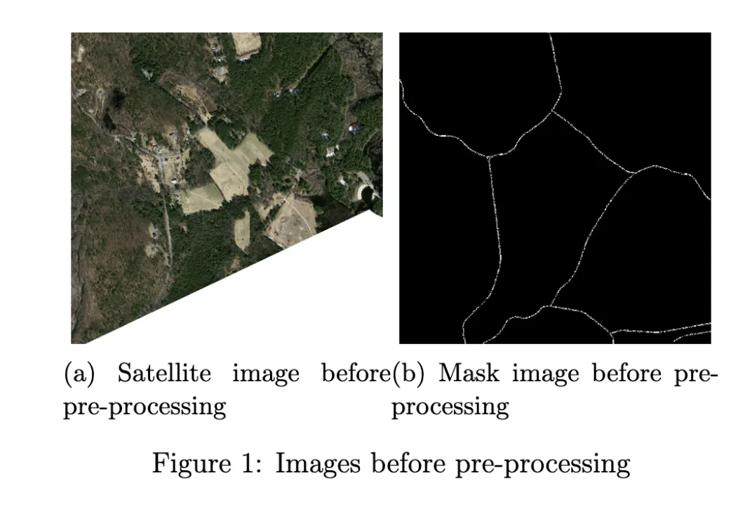
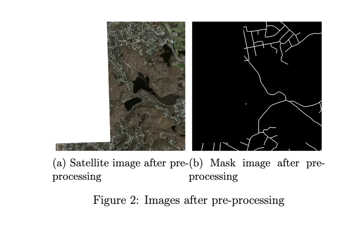
- Curated and preprocessed data from datasets like Massachusetts and SpaceNet, correcting known errors for model enhancement.
Media